While everyday day of the Everest Base Camp(EBC) Trek presented something new, some of the days were just memorable. The Ramechapp-Lukla flight on Day 2, the picture postcard views from Nangkartshang mountain on Day 7, the silent Thukla memorial on Day 8 and finally the long trek to EBC on Day 9. The single biggest variable that decides how much you enjoy the trek is the weather – clear skies are a must. Mornings are generally clear but post noon, increase in cloud cover is common.
A typical day would start with breakfast at 7am. After settling the payments due, we would leave around 8am. Lunch would be between 12 and 2pm en-route. And we would reach the next halt between 4 and 5pm. After hot tea, some rest, hot shower where available, it would be dinner at 7.30pm. After dinner, bit of chit chatting in the warm dining area before retiring for the night. On few occasions, I would take a walk outside. In the room, I would either read a book or play Sudoku before calling it a day.
DAY 2 – Uncomfortable transfers and Ramechhap to Lukla flight
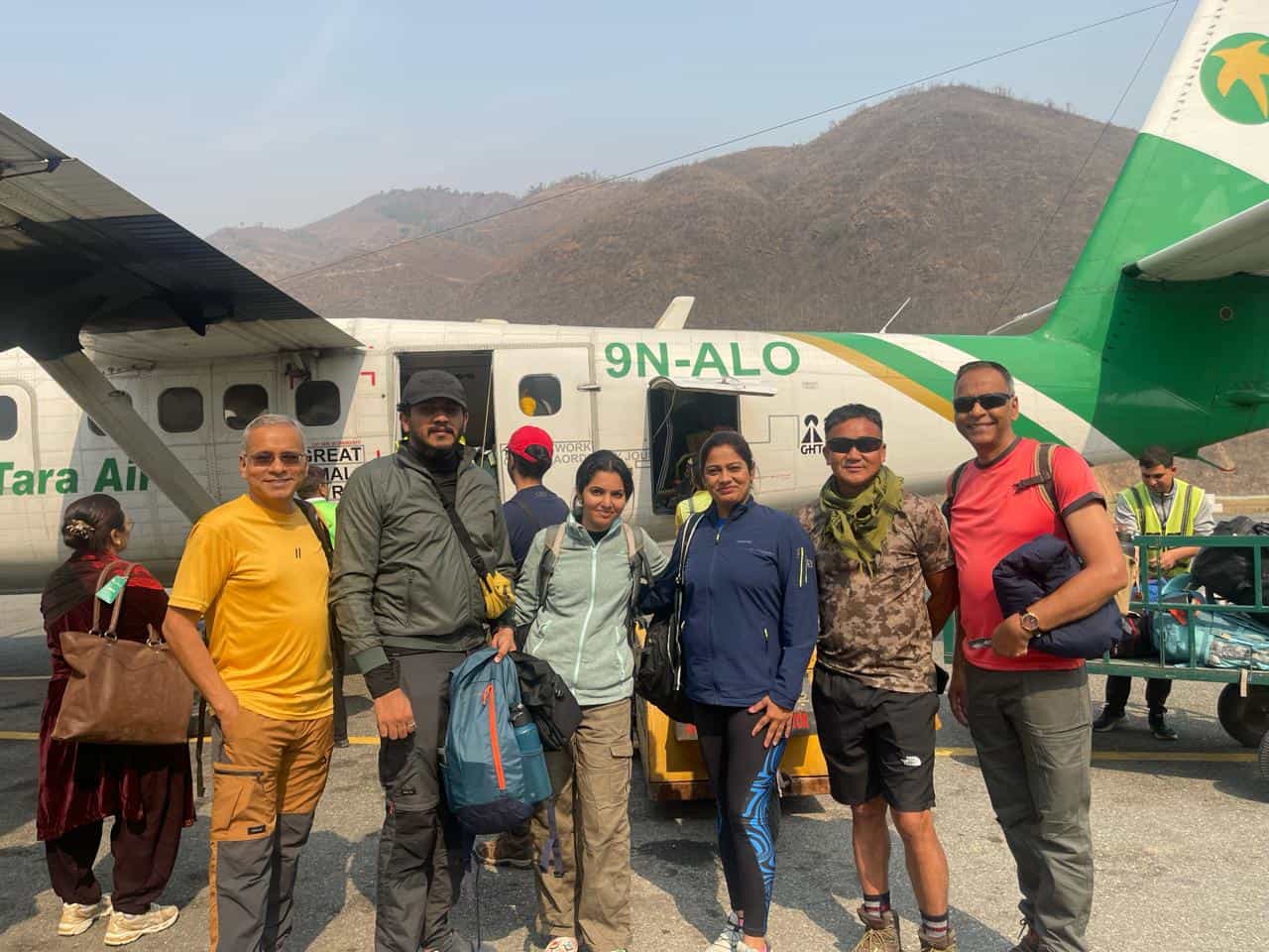
During the busy season(April, May, October, November), flights to Lukla operate from Ramechhap airport, about 140kms away from Kathmandu. I had to endure a very uncomfortable, dusty, post midnight journey of 4.5 hours, in a cramped non AC van over poor quality roads. It was a Toyota van but the size of the seats was small for adults. Arrived early morning in Ramechhap.
Ramechapp airport has a small café inside where I had honey toast and coffee. I was advised to avoid buying anything from eateries outside.
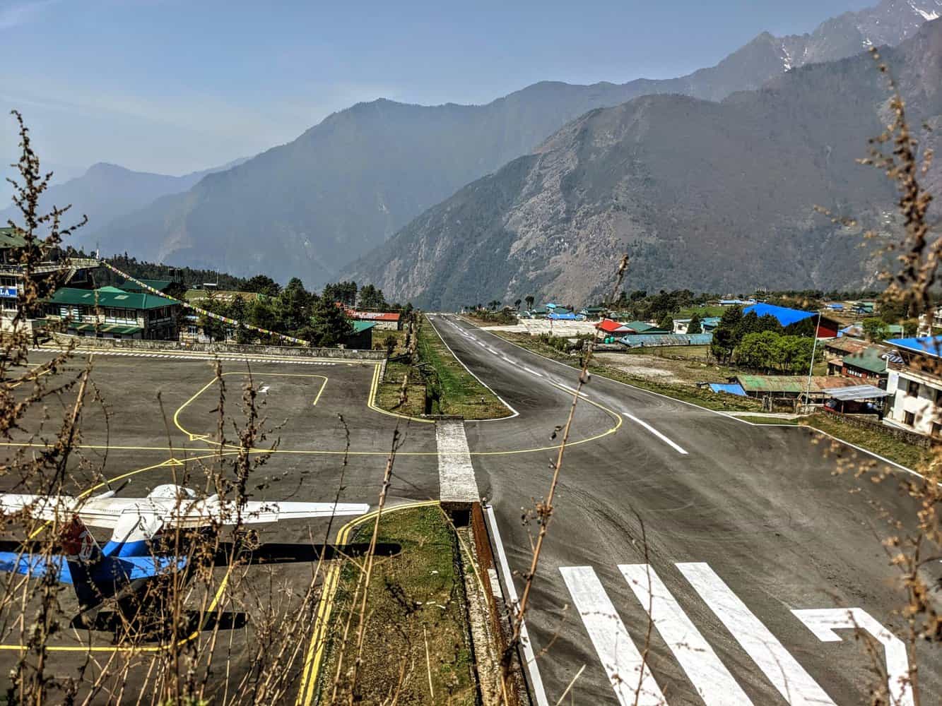
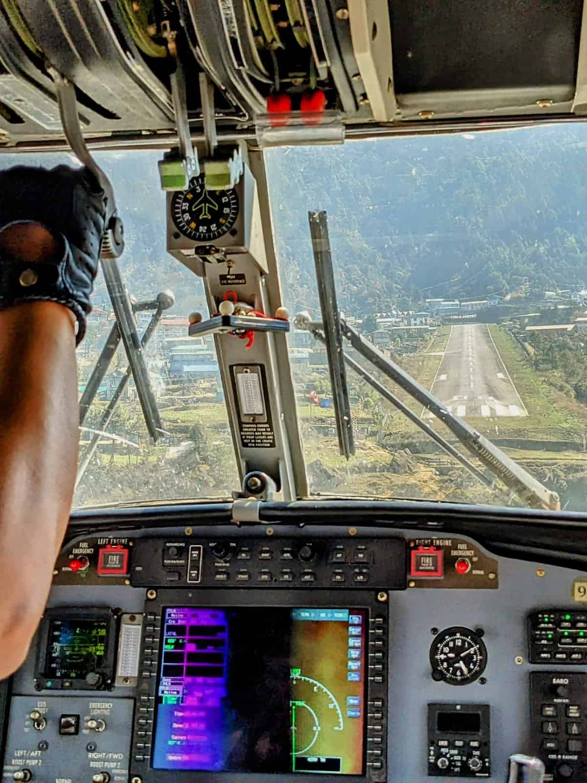
It was super exciting to get into a small 18 seater Otter plane operated by Tara Air. The maximum weight for both check-in and hand baggage is 15kgs but this is checked at a group level. I was among the first to get in and chose the window seat just behind the cockpit. This is possibly the best seat on the aircraft as I could look out without the wing and the propeller blocking the view and more importantly, I could also watch the pilots and the landing in Lukla through the windshield. The flight was a bit wobbly most of the time as it flew over mountain tops and passes. Perfect landing in Lukla after a 25 minute flight.
Form a vantage point near the end of runway, I watched a couple of flights landing and taking off. The sloping runway length is only 1700 ft. or so with steep valley at one end. No margin for any error by the pilots. The airport is rated among the most dangerous airports in the world. But Lukla is the gateway to the Everest region and thousands of trekkers and mountaineers safely pass through every year.
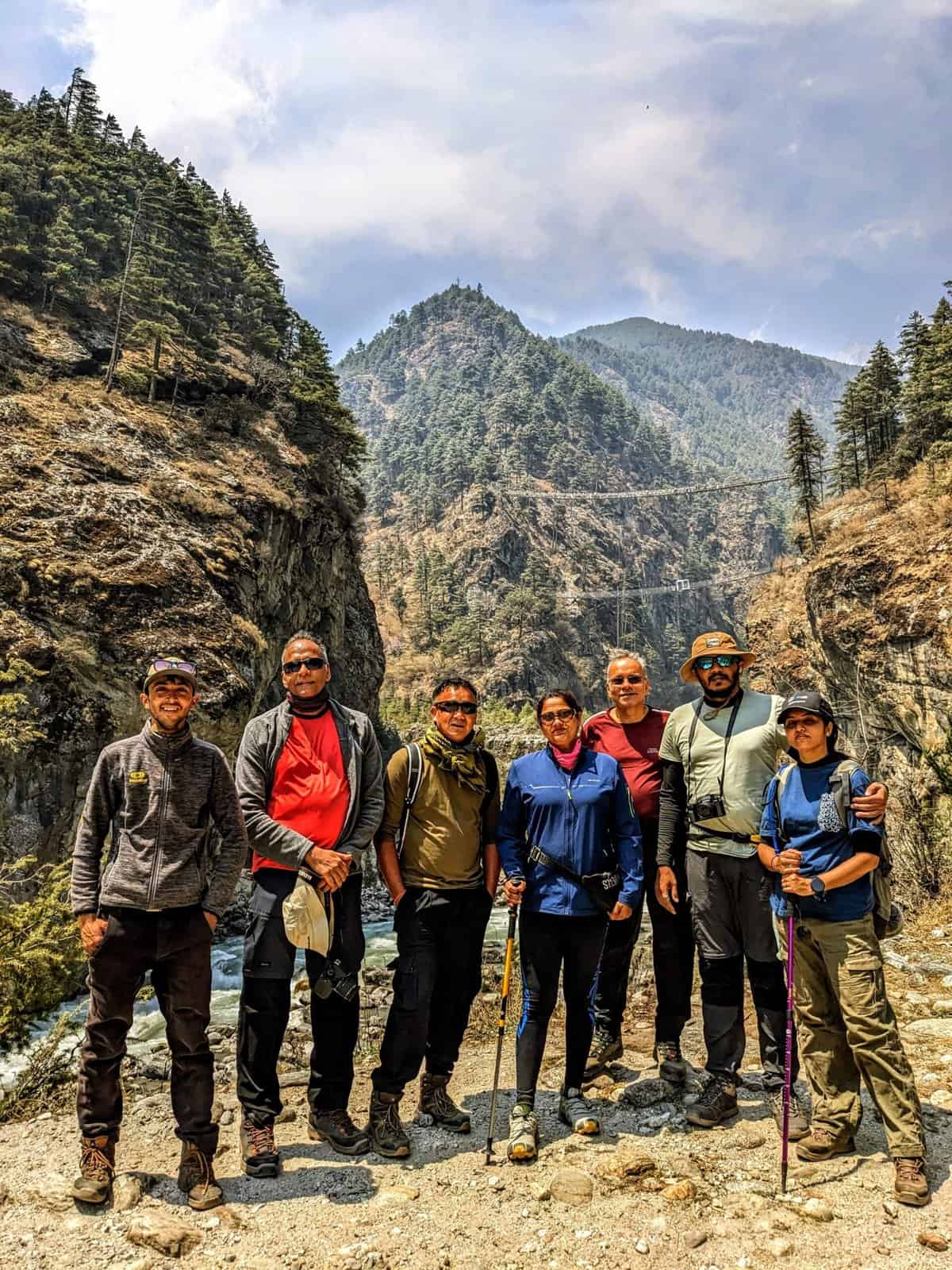
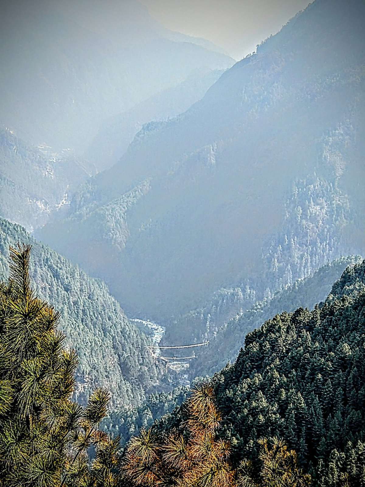
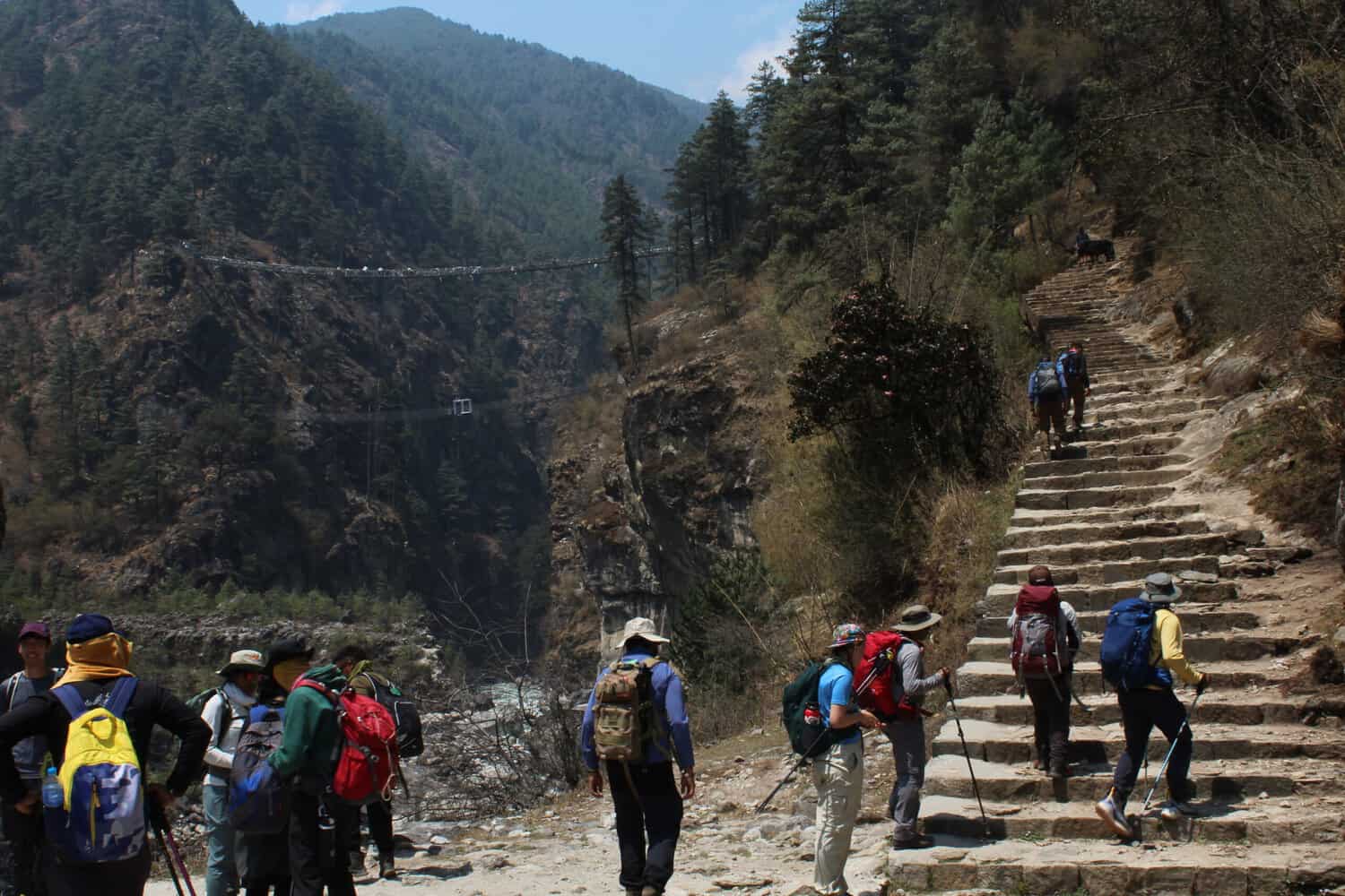
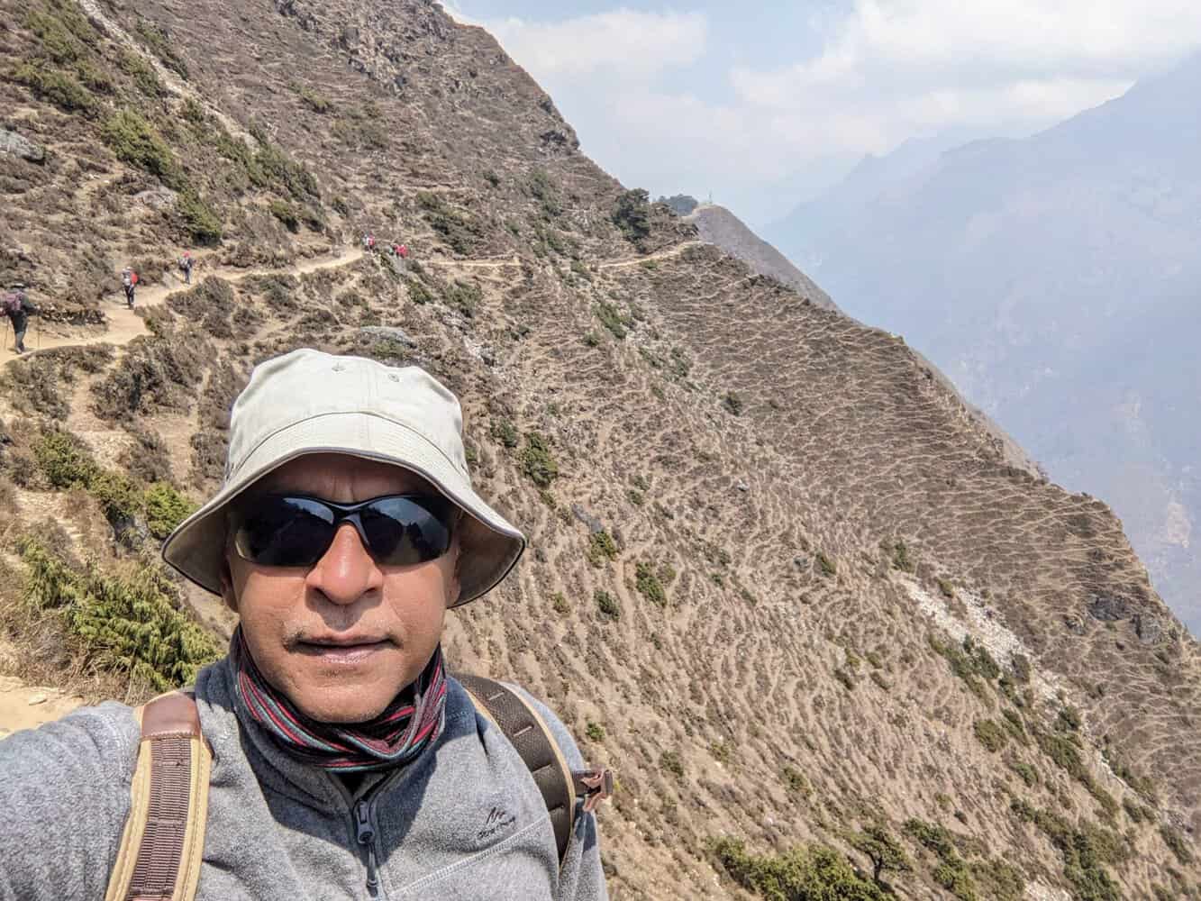
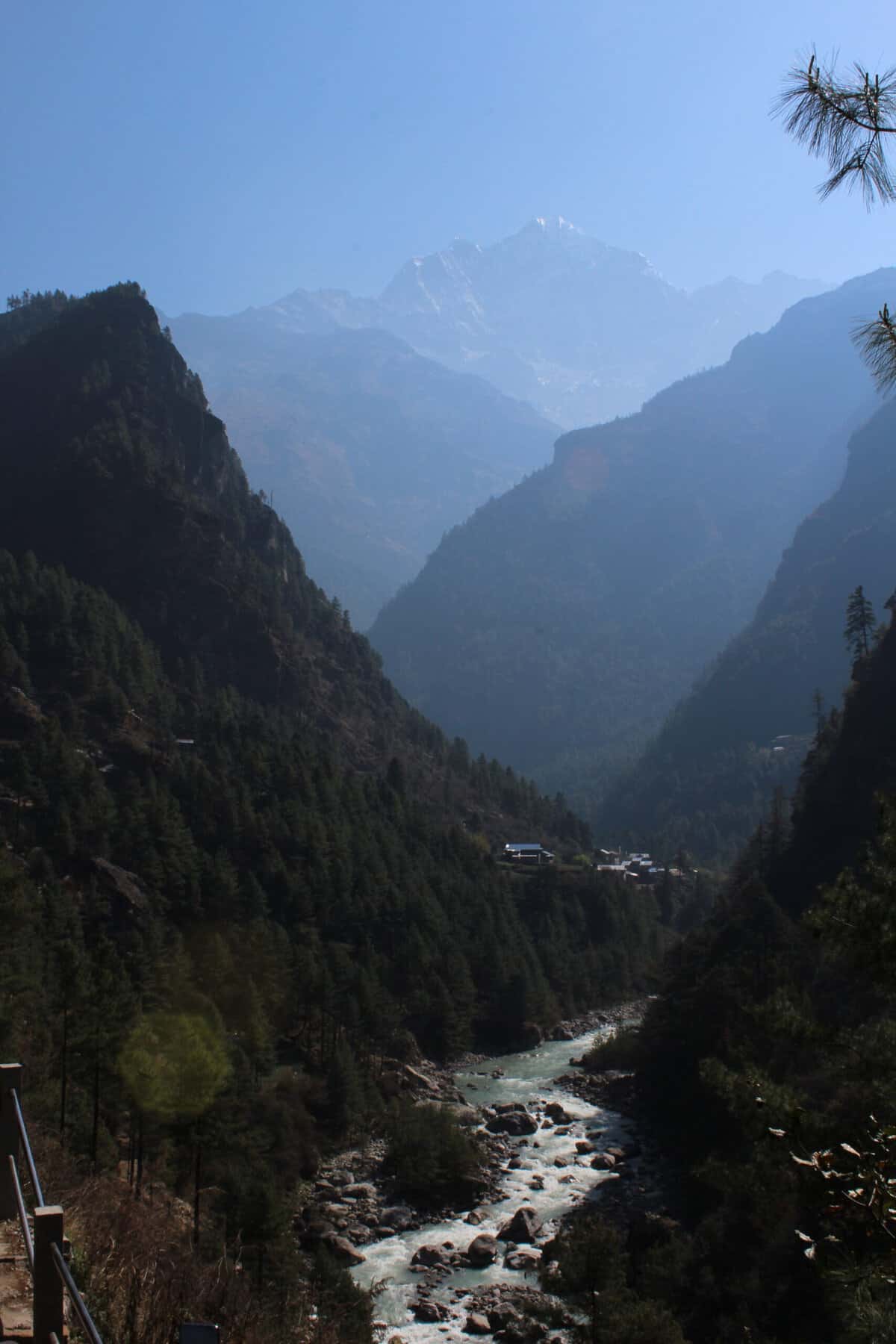
DAY 3 – The Hillary suspension bridge
Located just after Monjo on way to Namche Bazaar, the iconic Hillary suspension bridge has been built at a height of ~450ft. from the Dudh Koshi river. After the initial excitement died down, the realization dawned that I had to negotiate the steep climb to the Hillary bridge and cross over. The bridge itself is about 200ft. long and the wind is quite strong in the middle. I found it hard to click pictures while on the bridge because it was swaying continuously but the views from the bridge are fantastic.
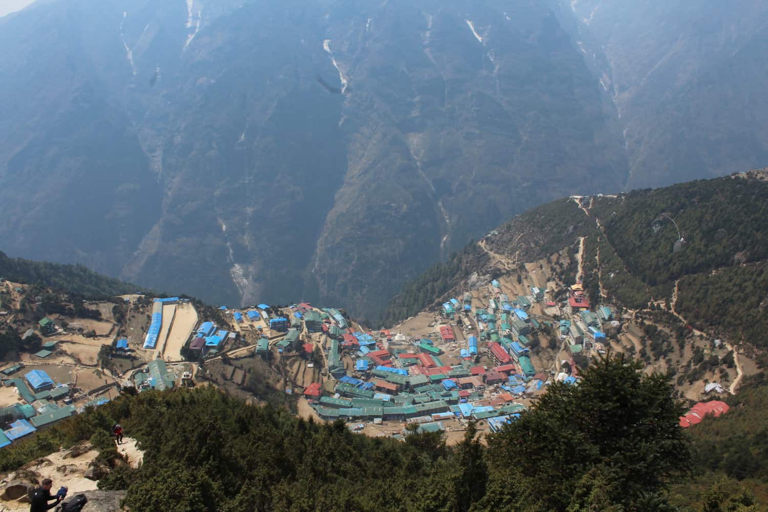
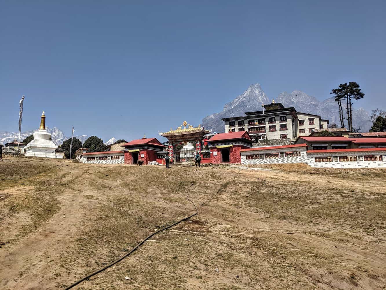
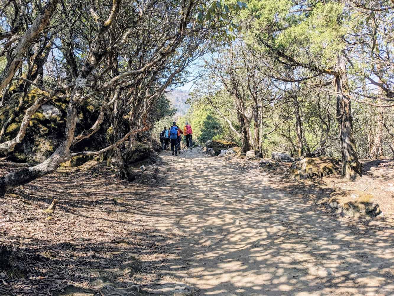
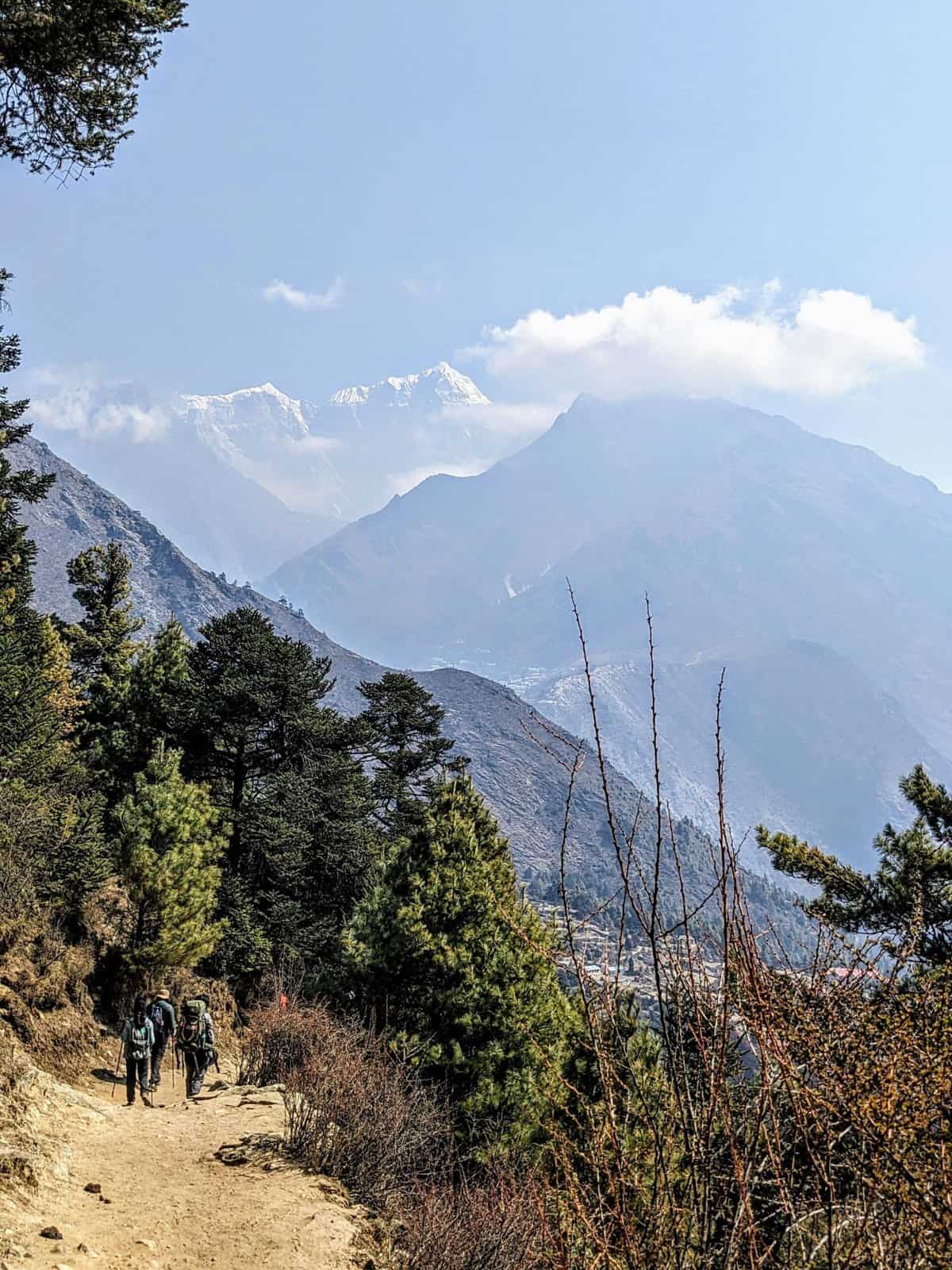
The climb to Namche Bazaar from here is quite steep and goes through forest area. Also very dusty. Namche Bazar will count among the liveliest small towns above 10,000 ft. With plenty of restaurants and shops, it is very colorful in the evenings.
DAY 4 – First distant views of Mt. Everest and Lhotse from Sagarmatha Museum
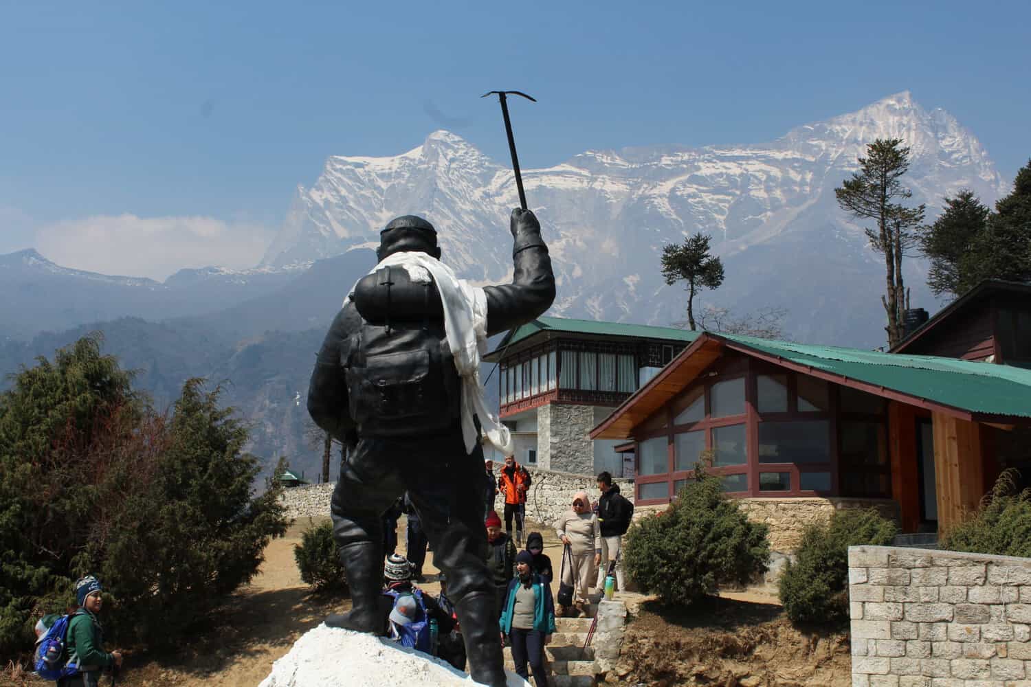
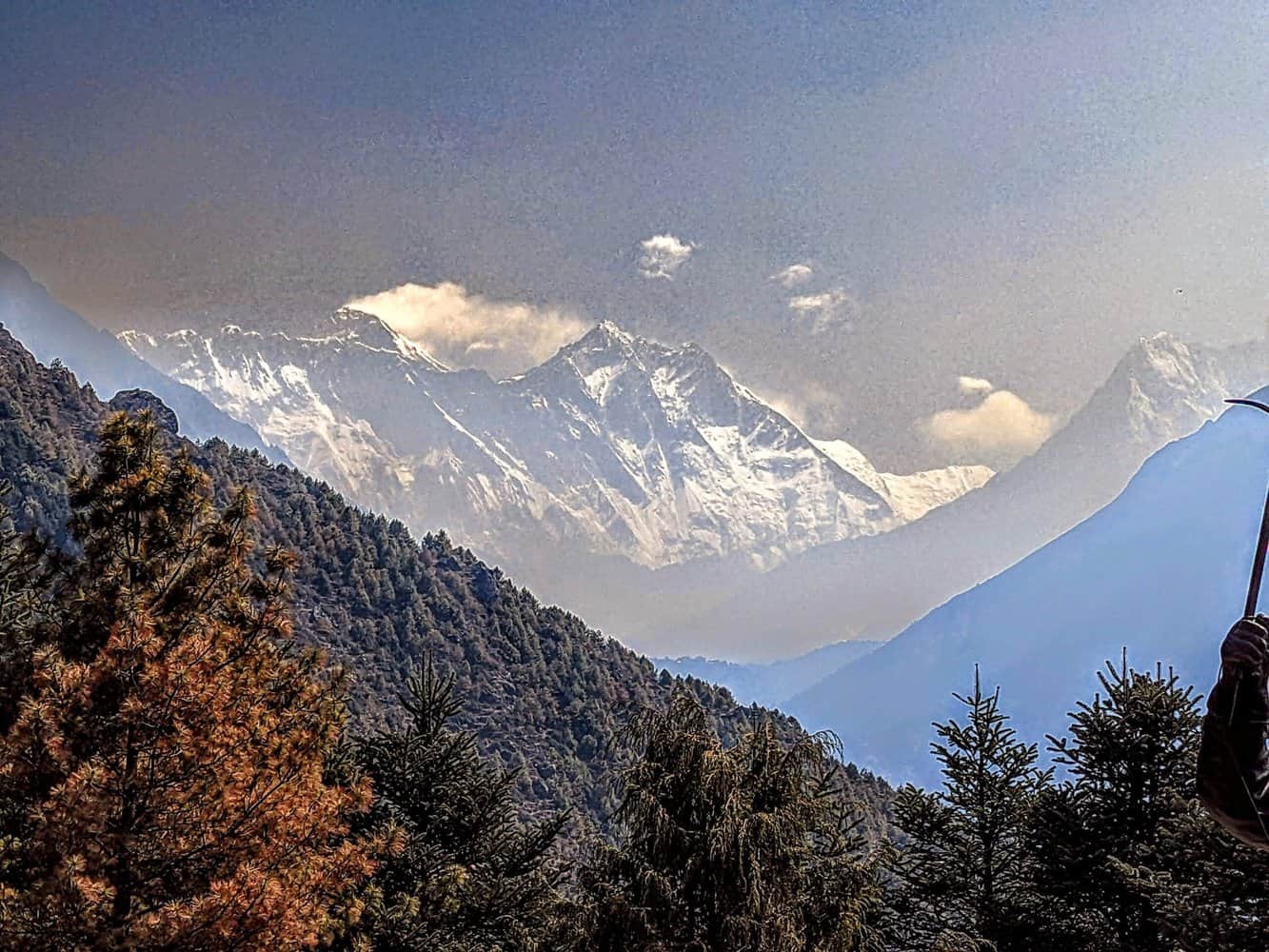
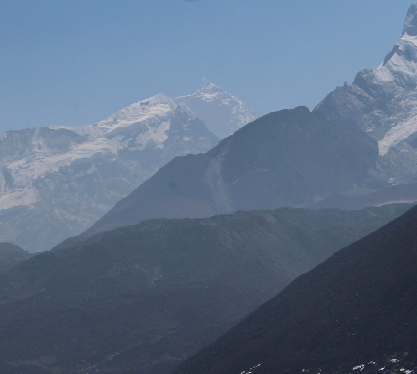
The Sagarmatha National Park Museum, Namche Bazar, is located on a hill surrounded by even taller mountains. Perfect location. Thanks to the sunny sky, I had the first clear view of Mt. Everest and Lhotse. And also Nuptse, Kangtega and Thamserku. Binoculars would have been handy but the camera zoom lens was not a bad alternative. Tenzing Norgay memorial is located here. The museum itself is quite informative and I enjoyed soaking up a bit of history.
The path from here to the famous Everest View Hotel through Synangboche airport was very windy and dusty. Mt Everest, Lhotse, and Ama Dablam can be seen from a view point en-route and also from the Hotel but I did not have any clear views due to cloud cover. At 13,000 ft., Hotel Everest View is stated to be the highest hotel in the world and provides magnificent views of the surrounding peaks and Mt Everest.

At the hotel helipad, I witnessed a helicopter make several failed attempts to land in gusty wind. It then moved away and landed safely from a different direction. So much depends on the skills and awareness of the pilots in the hilly regions.
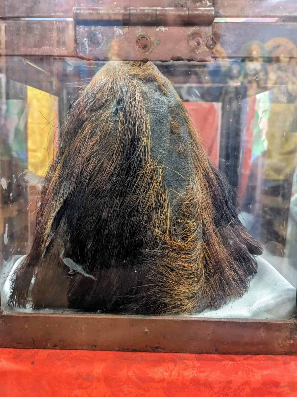
Overnight at Khumjung where the local monastery displays a ‘Yeti’ skull.
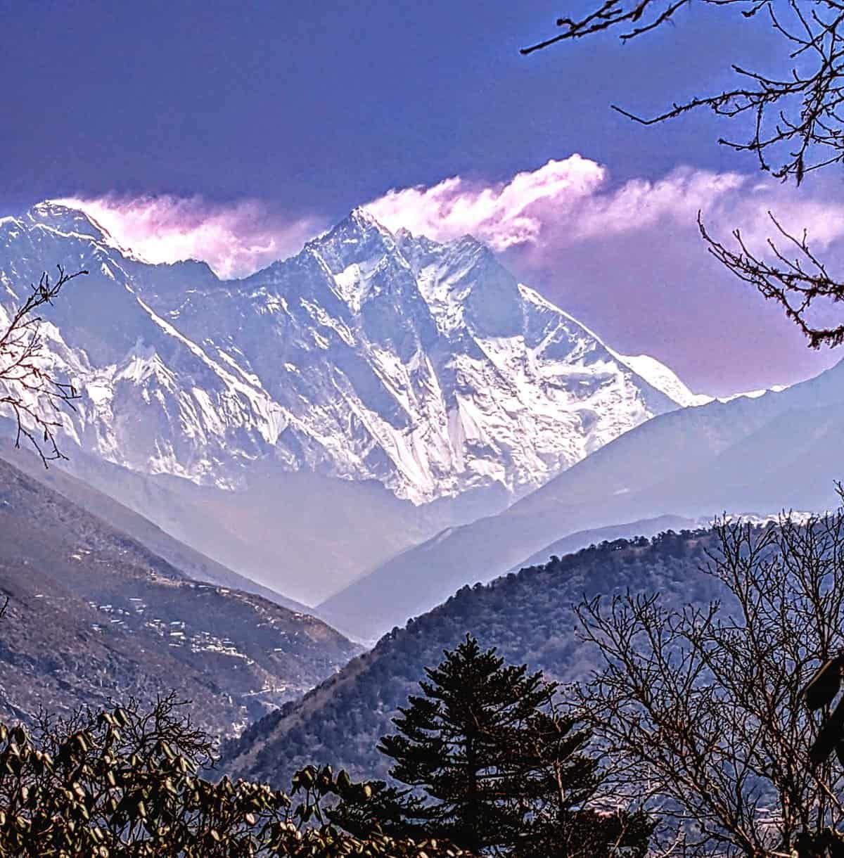
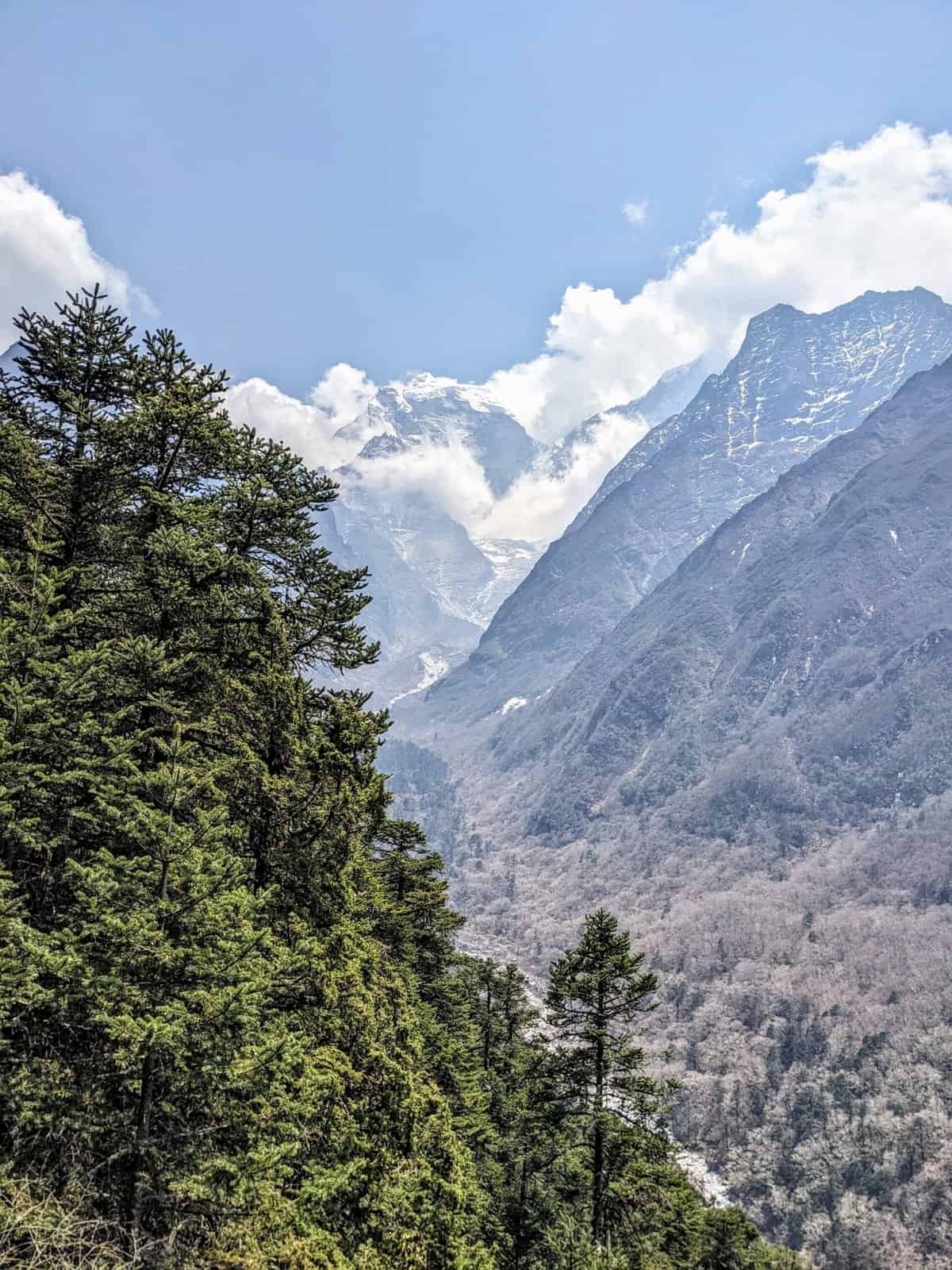
DAY 5 – Difficult trek, but fantastic views of Mt Everest and Lhotse from Tengboche
Khumjung to Tengboche is a difficult trek. Tengboche is only ~350 ft. higher than Khumjung but in reality, I climbed one forested hill all the way to the top before descending to Dudh Koshi river, crossed the river and again ascended all the way to the top of another hill where Tengboche is located. The inclination at times was like 45°. Overall, I climbed ~1750ft. and descended ~1400ft. After crossing the Dudh Koshi river, Rhododendruns were in full bloom all the way to Tengboche.
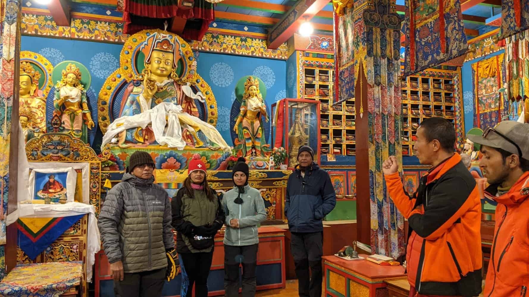
Lovely views of Mt. Everest, Lhotse, Ama Dablam and Kangtega from Tengboche. The monastery here is among the highest monasteries in the world.
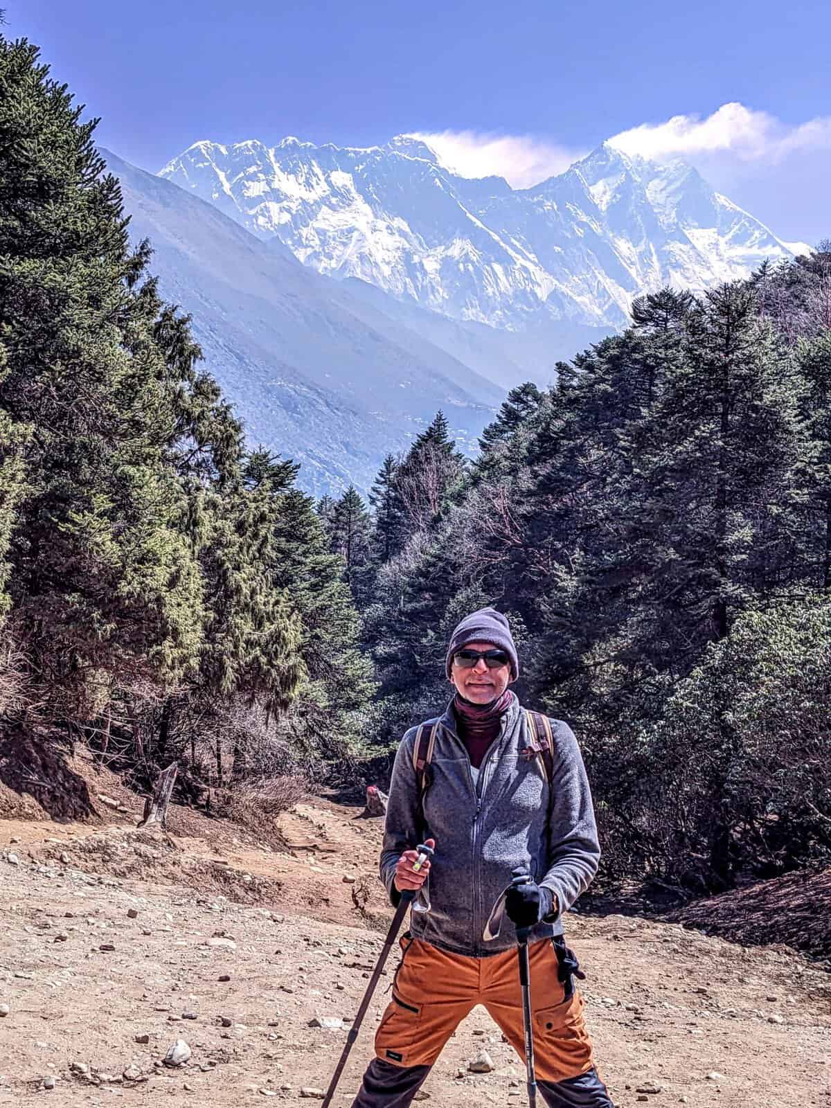
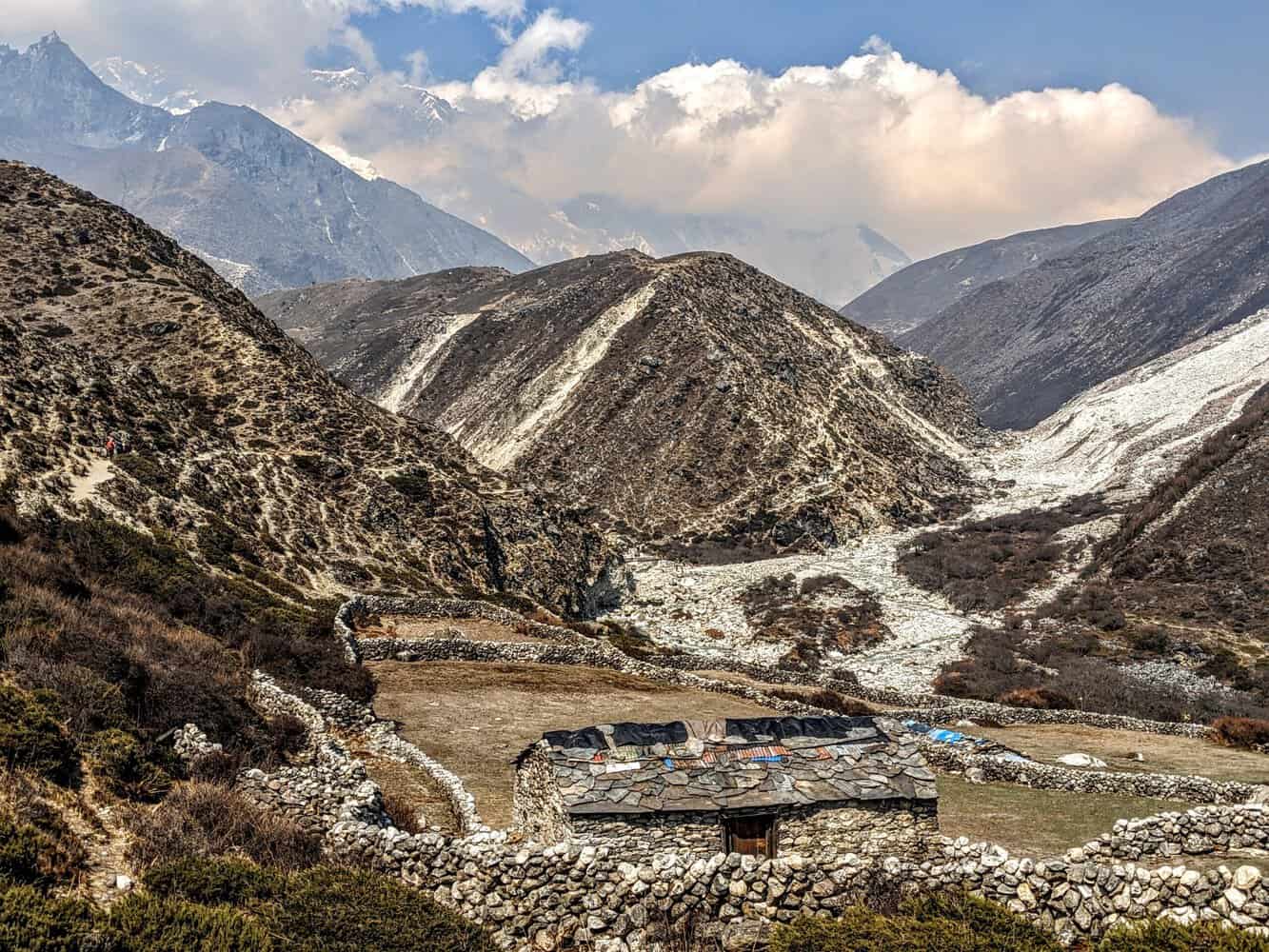
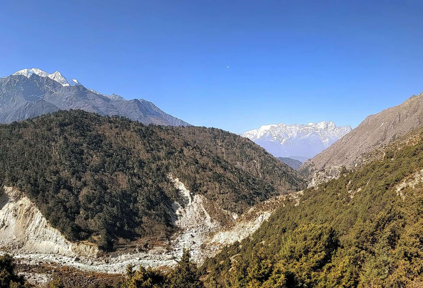
DAY 6 – The most scenic trek
Pangboche to Deboche is very green, with the path leading through forest area. Pangboche to Somare, where we halted for lunch, was a very scenic trek. The trekking path is located along the Imja Khola river but at an altitude and most of the time, I got clear views of Mt. Everest, Lhotse, Ama Dablam and Thamserku. Imagine walking with Mt. Everest and Mt Lhotse as the front screen.


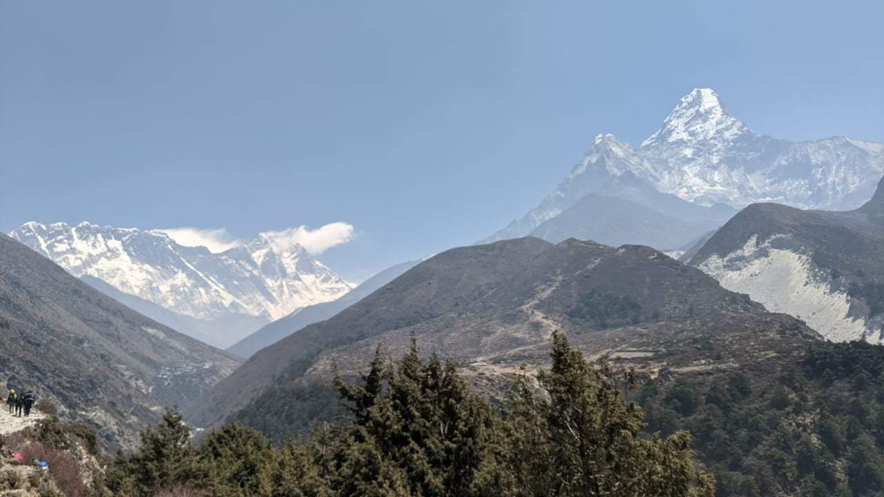
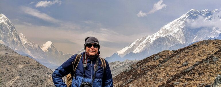
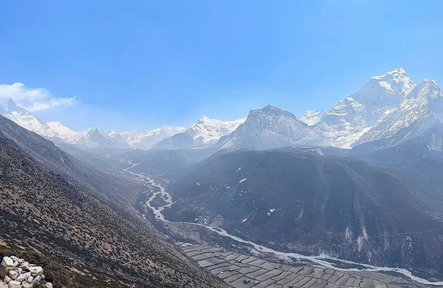
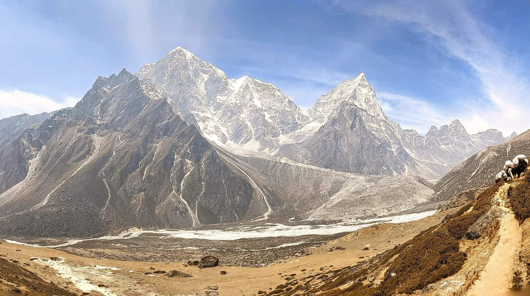
DAY 7 – Breathtaking views of mountain peaks and the valley
At Dingboche, Ama Dablam is very close and looked awesome during both sunset and surise. From the Nangkartshang peak, fantastic views of Mt Everest(8848m), Lhotse(4th highest peak-8516m), Makalu(5th highest peak-8485m), Ama Dablam(6812m), Nuptse(7861m) and Island Peak(6189m). And the Dingboche valley appears out of the world. It was like picture postcard. I could have sat here the whole day, munching dry fruits and sipping hot water!
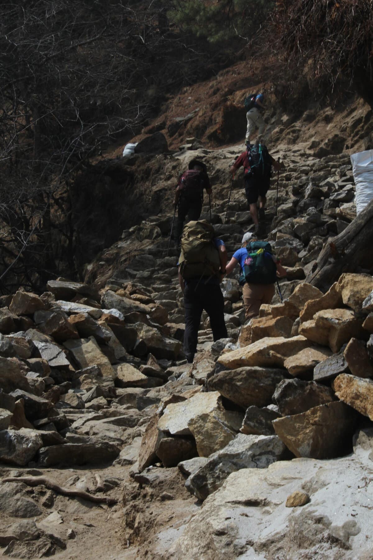
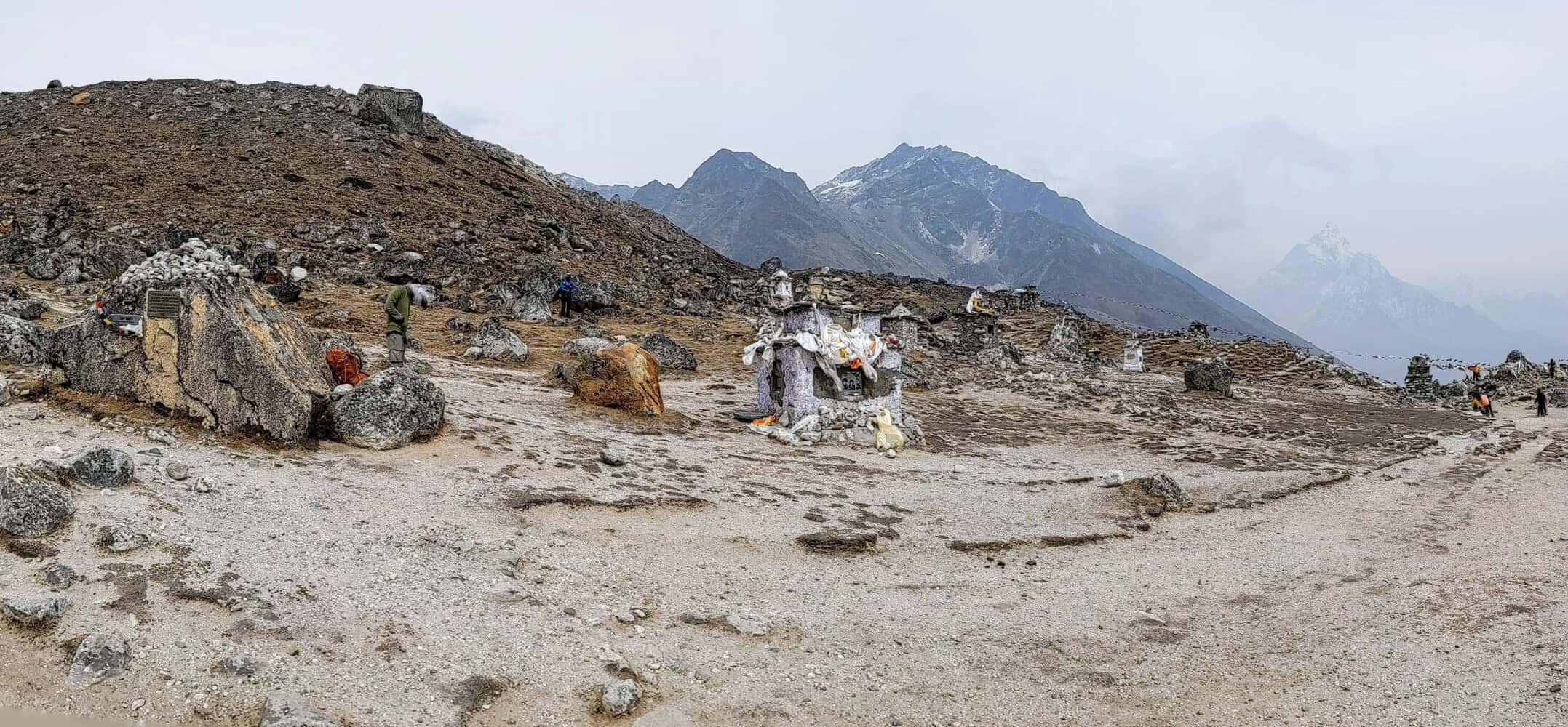
DAY 8 – The most difficult section of the trek but highly scenic
The guide warned us that today was the day when we encounter the most difficult section of the trek – the climb to Thukla pass(~500m) and that too right after lunch at Thukla! There were actually two sections that were quite steep. I eventually managed it comfortably. At the top, which is the start of Thukla pass, there are over 100 memorials in honour of those who lost their lives climbing Everest and also those who died during the avalanche at the EBC in April, 2015. Spent few quiet moments here. I spoke to a trekker who had placed a bunch of flowers on the memorial of Anjali Kulkarni. Learnt that she lost her life as she ran out of oxygen while descending during the widely publicized ‘traffic jam’ on Mt. Everest in 2019. Quite tragic. And touching.
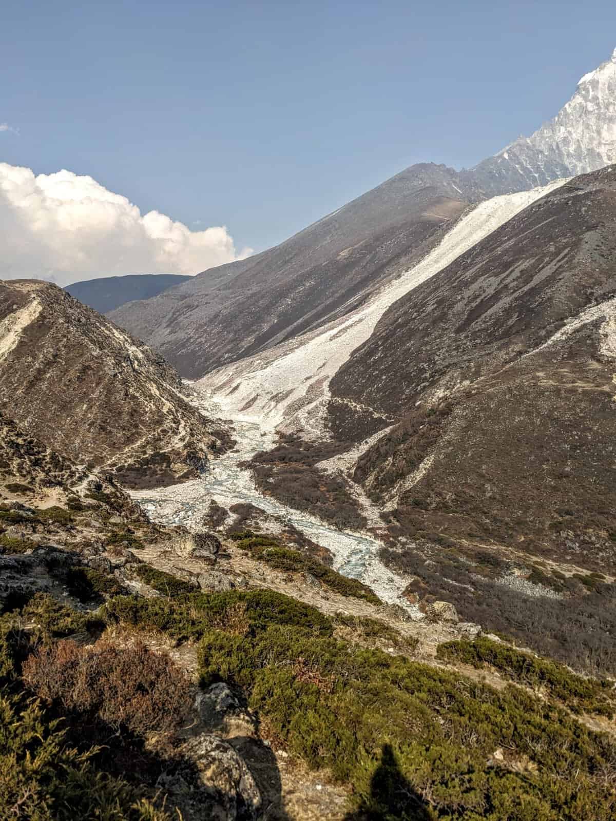
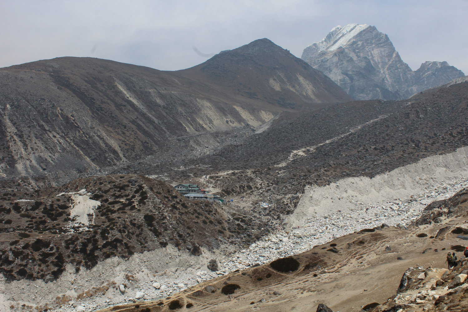
On way to Lobuche, enjoyed magnificent views of Mt Lobuche, Mt Pumori, Mt. Khumbutse and Mt Nuptse. The terrain too felt as if I was walking on the moon! There is no vegetation beyond Dingboche and the terrain gets very rugged.
I was now at over 5,000m(~16,500 ft.) above sea level.

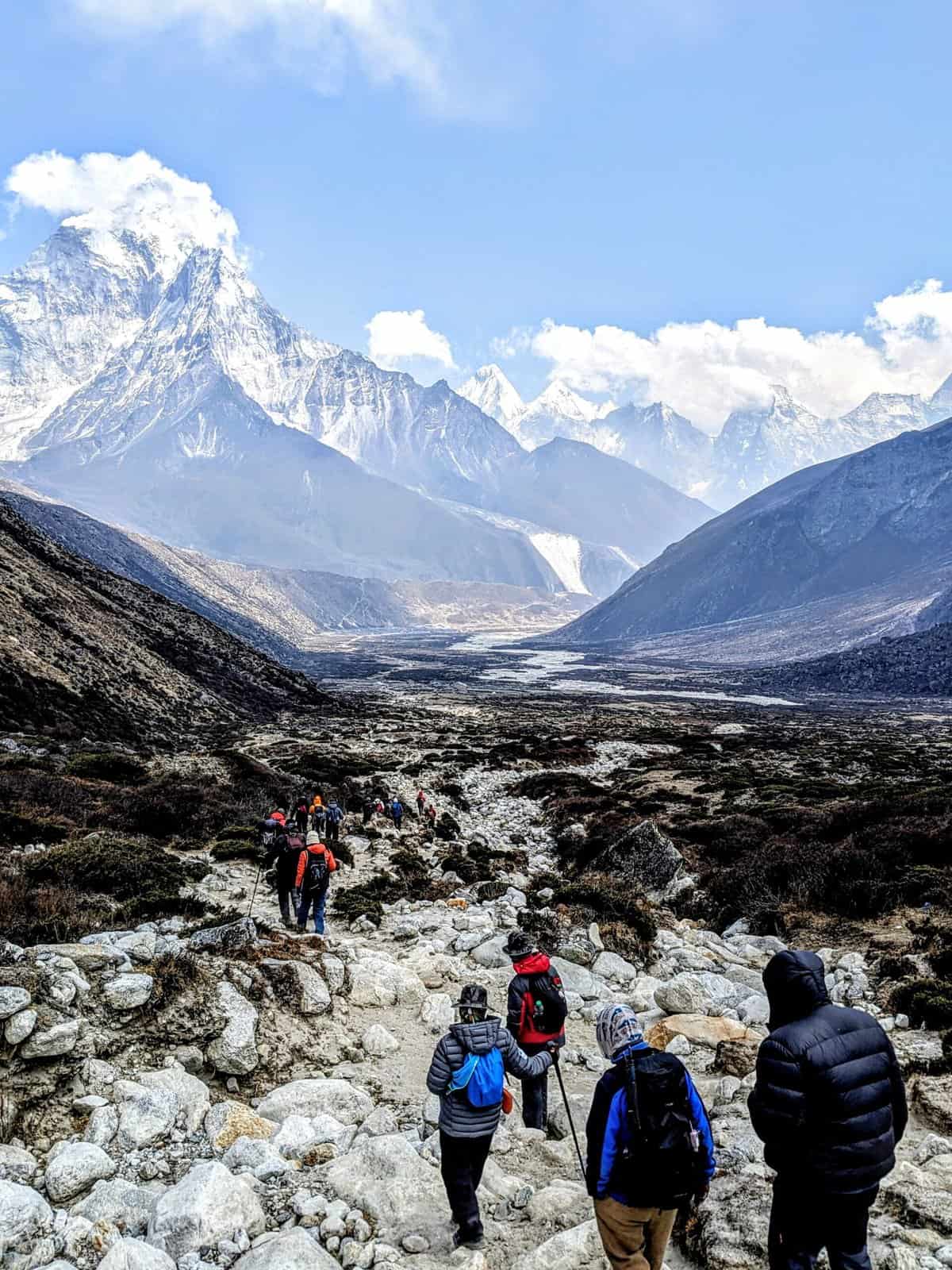
DAY 9 – The D Day. Difficult path
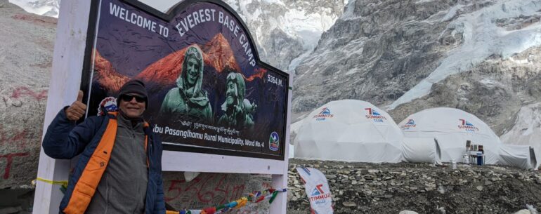
The D-Day and the longest day of the EBC trek on the way up. Almost 11 hours. The trek was bit difficult more because of the path – the rocky terrain meant I was walking on boulders and rocks most of the time. Great views again and just before descending to Gorakshep, the EBC was visible at a distance. An hour or so after Gorakshep, the top of Mt. Everest was visible. Walked along the Khumbu glacier(minus snow) before a steep descent to EBC. As expected, there were lot of tents spread over a large area and barricaded by a simple tape. Only mountaineers with permit to climb Mt. Everest or Lhotse are normally allowed in the camp but some organizations are able to get permits for trekkers to also halt at EBC for a night or two. . Thankfully, the Khumbu icefall here looked majestic with snow cover.
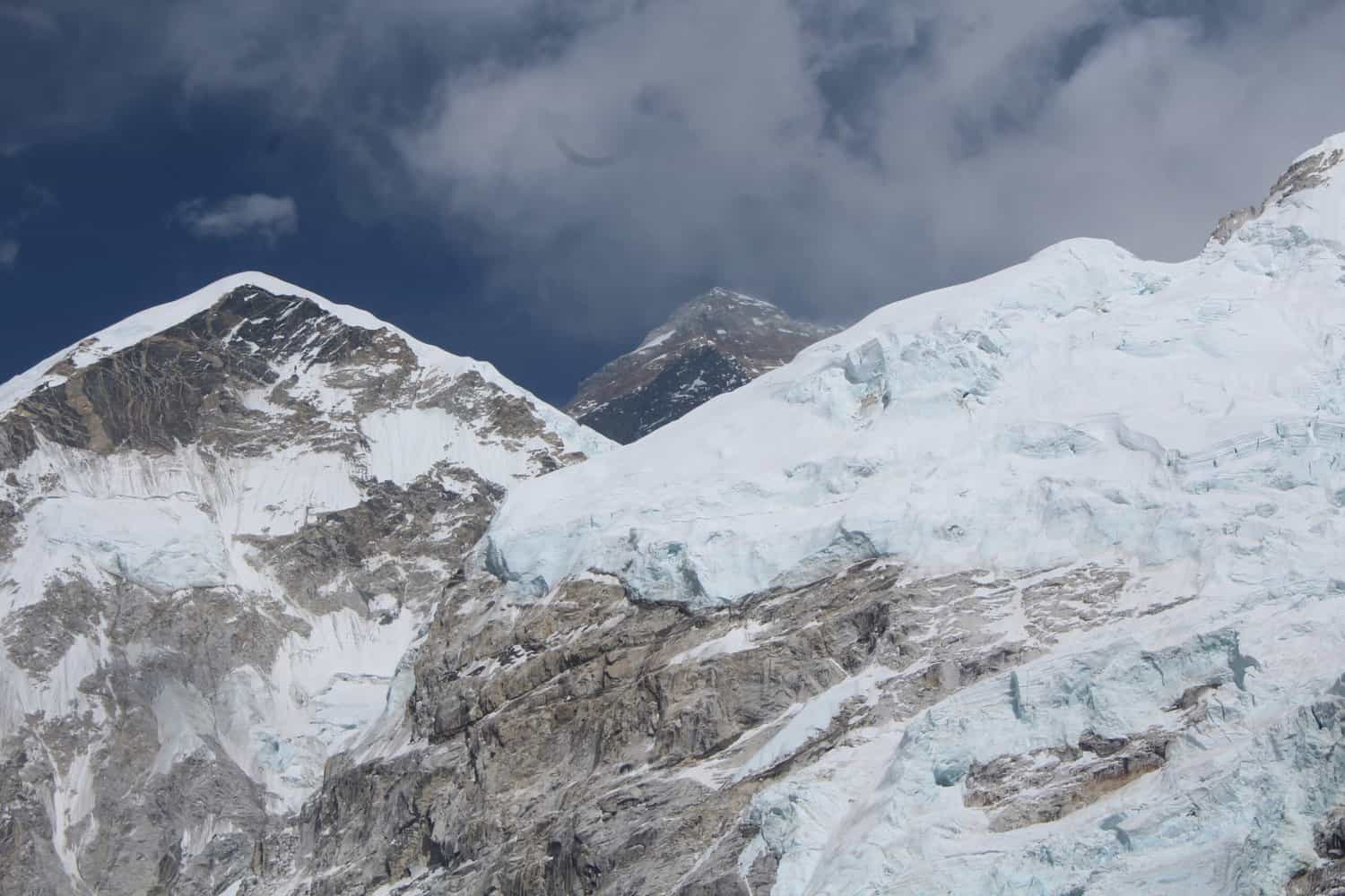
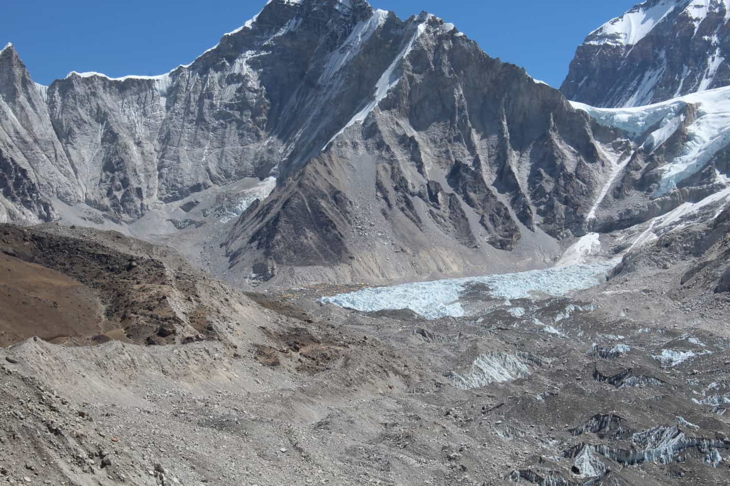
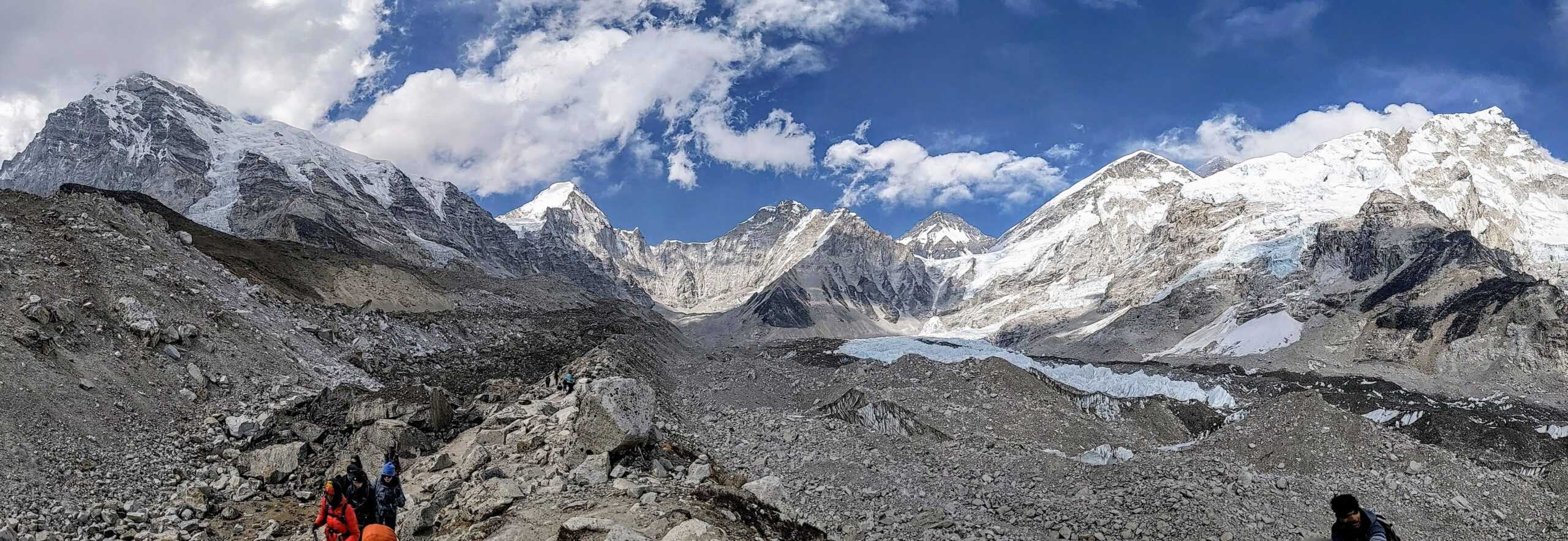
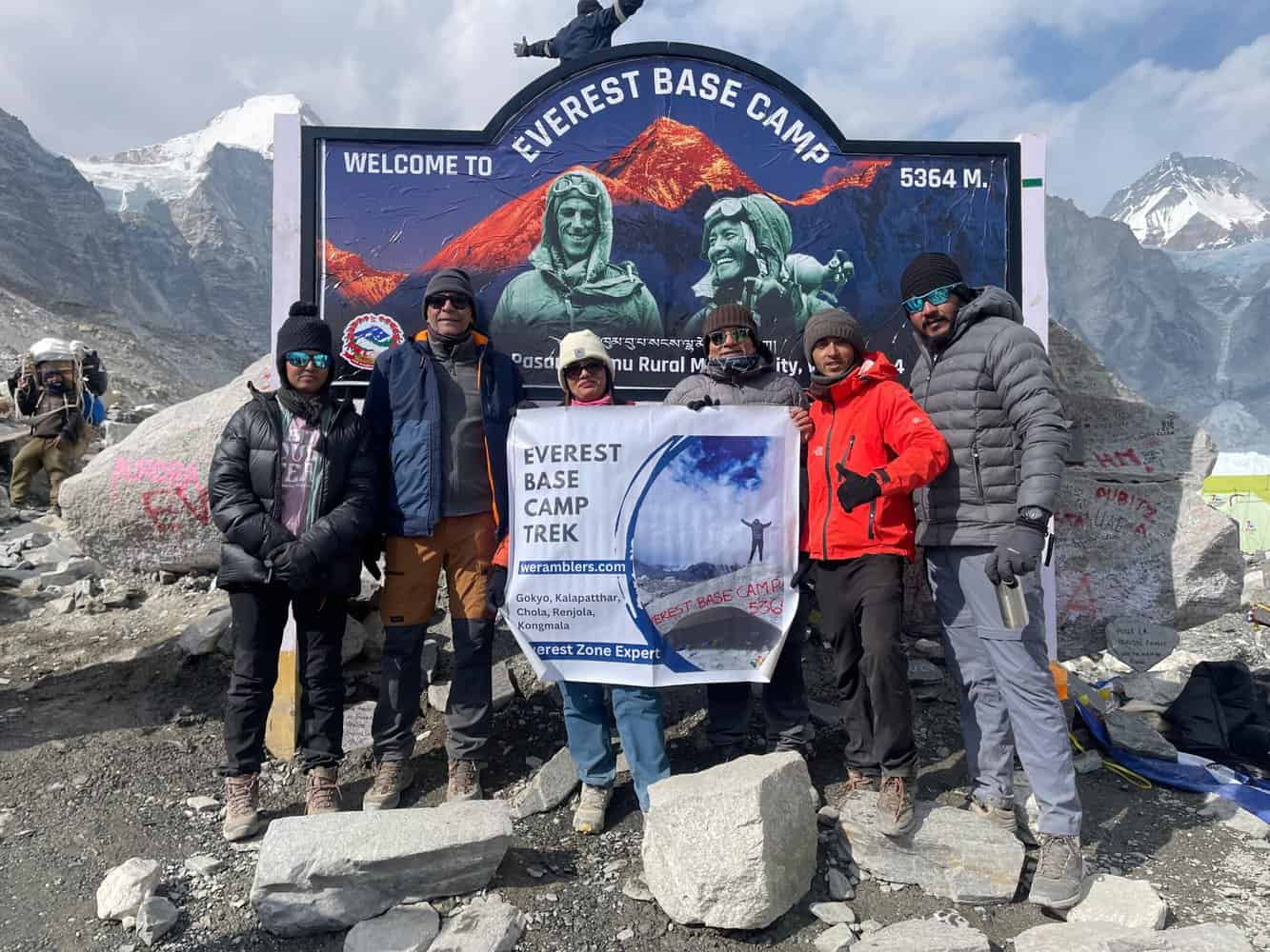
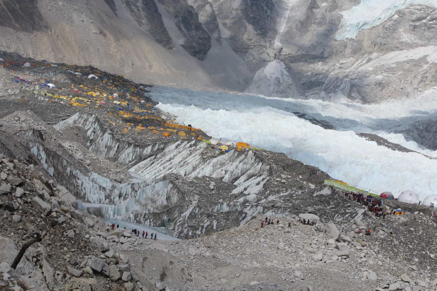
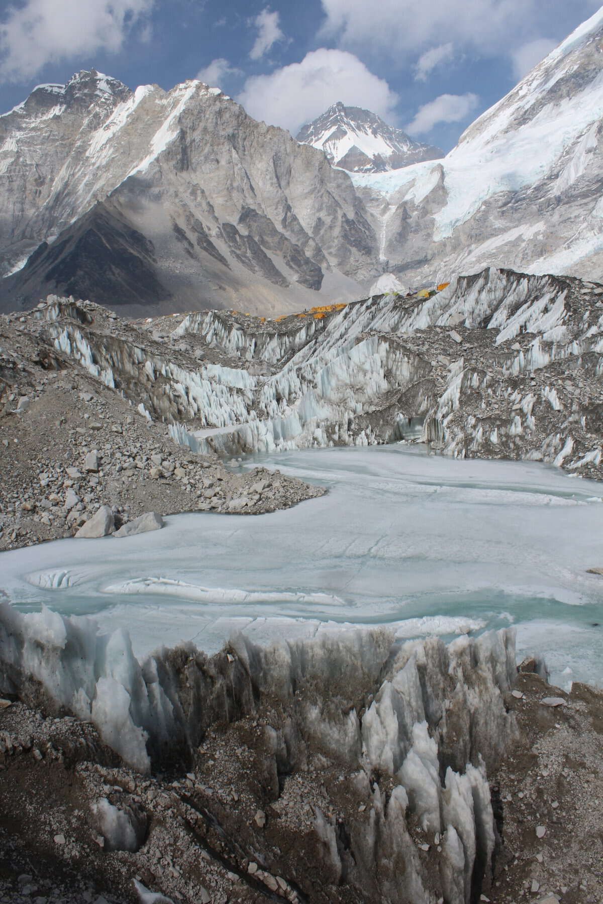
From the EBC, Mt Everest is actually not visible. Neither is Lhotse. The EBC is surrounded by some of the other tallest peaks in the world such as Changtse, Nuptse and Pumori and the landscape is simply spectacular. The peak behind the rock where all trekkers take pictures is actually the highest peak of China, Changtse(7543m). So here I was, at 17600 ft. above sea level, and just 11,400 ft. separated me from Mt Everest! It was a very humbling experience.
I reached EBC around 3pm and it was almost 5pm when I started the journey back to Gorakshep.
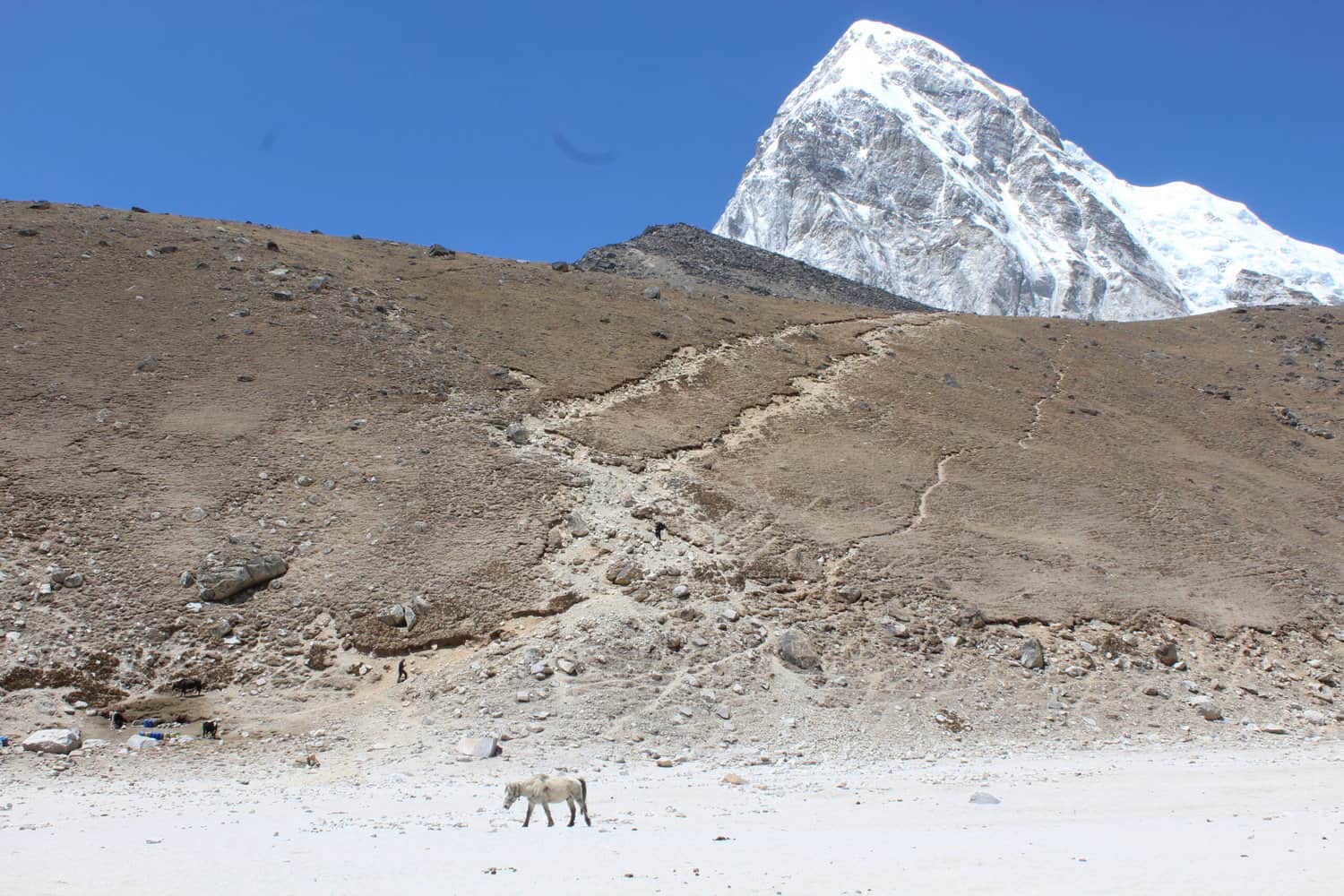
Why I skipped Kala Pathar?
The trek to Kala Pathar was planned at 3am in the morning of Day 10. The previous day was very long(almost 11 hours) and I reached the Tea House at Gorakshep around 6.45pm. Not much time for rest before attempting the climb to Kala Pathar that is said to be very steep and most difficult climb of the entire EBC trek. Secondly the photos suggested that while the views from Kala Pathar are spectacular(very much like the views from Nangkartshang peak), a portion of Mt. Everest is still hidden behind another mountain. I would have been ready for the climb after sunrise but that option was not available.
Not everyone on the EBC trek attempts to climb Kala Pathar. And among those who try, many turn back midway. One can also ride a horse to Kala Pathar for USD 150/200.
Day 10-12 Gorakshep down to Lukla
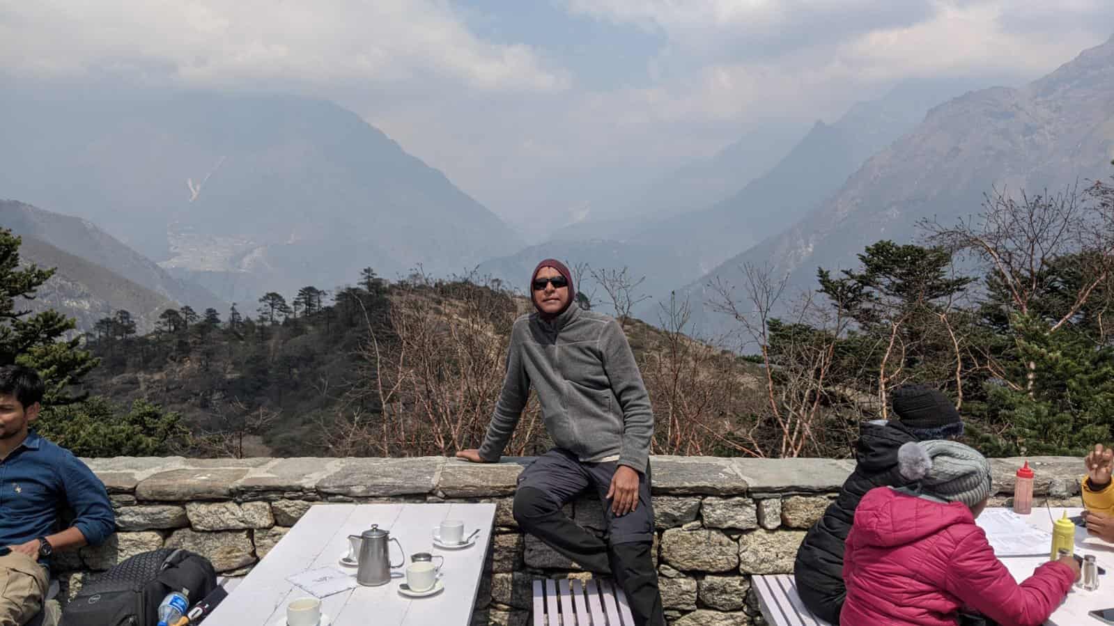
The way down was more taxing on the knees and the toes. So much so I started ‘landing’ on my heels rather than toes to ease the pressure. Since physical tiredness was beginning to hit my body, there was one feeling that was consistent – the enormity of the uphill trek to EBC. I would often wonder how could I manage it without much difficulty. The best part of the downhill trek was that I did not have to compulsorily eat ‘Dal-Bhaat’ and could have coffee. But I avoided hard liquor until I reached Lukla where I had a fair share of the local alcoholic drink made out of millets. Enjoyed freshly brewed coffee at Café Altitude in Pheriche, Namche Bazar(plenty of cafes) and then at Himalayan Sherpa Café, about an hour before Lukla. Heavenly, despite use of milk powder.
8 days required for upward climb
In all, I think 11 days of up and down trek is just about the limit. Maybe one more day would have been fine but thereafter, each additional day would get progressively difficult for someone like me who does not trek in the mountains very often. I also think 8 days is the bare minimum for the trek from Lukla to EBC. Acclimatization would suffer if this period were to be curtailed, exposing one to the risk of mountain sickness. But a question still remains – when the treks are scheduled to perfection, what happens if there are disruptions due to bad weather – either to trek or flight schedules?
How did I cope medically?
Quite well actually. I did have very minor symptoms of high altitude but my body coped very well. I did not take any medications, including Diamox,
Acute Mountain Sickness(AMS)
At one climbs to higher altitudes, the atmospheric pressure and the density of air decreases. As a result, the oxygen molecules are spread further apart, thereby lowering the amount of oxygen(effective oxygen %) intake in each breath. The total percentage of oxygen in a given volume of air remains the same though. At 17,000 ft, the effective oxygen level is just 11%.
The human body will acclimatize to this lower effective oxygen level, provided it is given sufficient time and the ascent is slow and steady. First recommendation is to drink 3-4 litres of water every day. Another suggestion to aid acclimatization was to consume garlic and ginger. I would normally have garlic soup in the evenings and ginger water in the mornings/afternoons. Many trekkers opt to take Diamox tablets.
Oxygen saturation levels decreases with ascent
My oxygen saturation level was 96% at Namche Bazaar, and it came down by 3-5% points everyday to 80% at Gorakshep. The threshold is 70%. If it falls below 70%, the advise would be to head down to lower altitude asap.
Oxygen cylinders cannot be used off and on
I was under the impression that if one has difficulty in breathing, one can simply use an oxygen cylinder for few minutes. That was my belief when I went to Ladakh in 2020. How naïve! What I understand now is that oxygen is given only when evacuation is imminent. Otherwise, if one breathes fresh oxygen from a cylinder, the ability to breath normally in the rarefied atmosphere at higher altitudes is lost. So unless you have adequate number of cylinders to last your entire stay at high altitudes, this is not an option.
Pulse rate was above 90 but blood pressure is not normally measured
The pulse rate stayed above 90 even at Namche Bazar and was 95-98 whenever measured. Said to be normal at higher altitudes. The heart rate goes up to get more oxygen to the body. Blood pressure is also supposed to increase at higher altitudes but this was not measured.
Night sleep was shallow
Generally, I had 3-5 hours of deep sleep followed by shallow sleep. I would go to bed around 9.30-10pm and wake up around 2-3am. But still, I would feel fresh the following day. I was advised not to sleep in the afternoon but I did manage to take short naps(upto 1 hour) wherever possible.
Nausea and headache
At Namche bazaar, 11,300 ft., I had a mild sense of nausea. Eating dinner in the evening was an effort but I managed as my guide kept reiterating it is very important to eat well in the evenings to prevent onset of AMS. I felt normal after overnight sleep.
The evening I reached Lobuche(~16,200ft.), I felt a minor headache. Maybe not exactly an ache but some king of light pressure on the sides of the forehead. The guide asked if I felt any ache at the back of the head as aches at the back of the head is a symptom of AMS. Thankfully, that was not the case. He suggested I could take a tablet for headache but I decided not too. Did not feel like eating food but somehow managed. Felt fully normal the next morning.
Dry cough and running nose
This is common throughout the trek. Initially, I thought the dry cough was a consequence of dust but later learnt the altitude with its thin dry air, has a big role to play. Locally known as ‘Khumbu cough’.
Running nose is equally common even if there is no ‘cold’. Had that for 3-4 days and though it was mild, it was quite inconvenient to blow the nose frequently given the attire.All trekkers will exhibit mild sympto
Almost all the trekkers will have the above symptoms that are mild and goes away after overnight sleep, or medication. I was fully normal well before I returned to Lukla.
Should one take Diamox(Acetazolamide)
The big question that confronts every person planning to trek to high altitudes is whether to take Diamox. Now Diamox is supposed to lessen the symptoms of mountain sickness. It does not prevent mountain sickness per se but helps the body in acclimatizing to higher altitudes. One argument obviously is that after all the preparation and expenditure, it would be very disappointing to turn back without reaching the EBC. Other argument is to take things as they come and many are able to manage comfortably without taking any tablets. Besides, AMS needs to be treated as soon as the initial symptoms appear. Diamox may delay the onset of symptoms, thereby delaying treatment.
Ultimately, it is a personal choice. If you decide to take, do consult a doctor. In India, prescription is required to buy Diamox. In my group too, few took tablets and few did not, including me. The guide normally carries Diamox(or local equivalent) but it is administered only if symptoms of High Altitude sickness appears. Not otherwise.
Limited access to medical facilities
One good reason to exercise caution and be aware of what is happening to the body is that medical facilities may not be accessible immediately. There are hospitals at Lukla, Phakding and Pheriche, and clinics at Namche Bazar, Dingboche and Gorakshep. The EBC camp too has a clinic. But given the mountainous terrain, it may take time to reach the nearest facility.
Related posts
All about Everest Base Camp Trek
Tea Houses on the Everest Base Trek
Discover more from My Travel Innings
Subscribe to get the latest posts to your email.